
Crises in South Africa
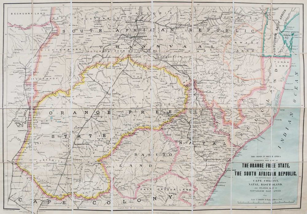
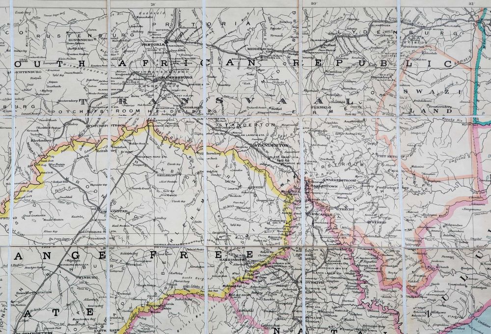
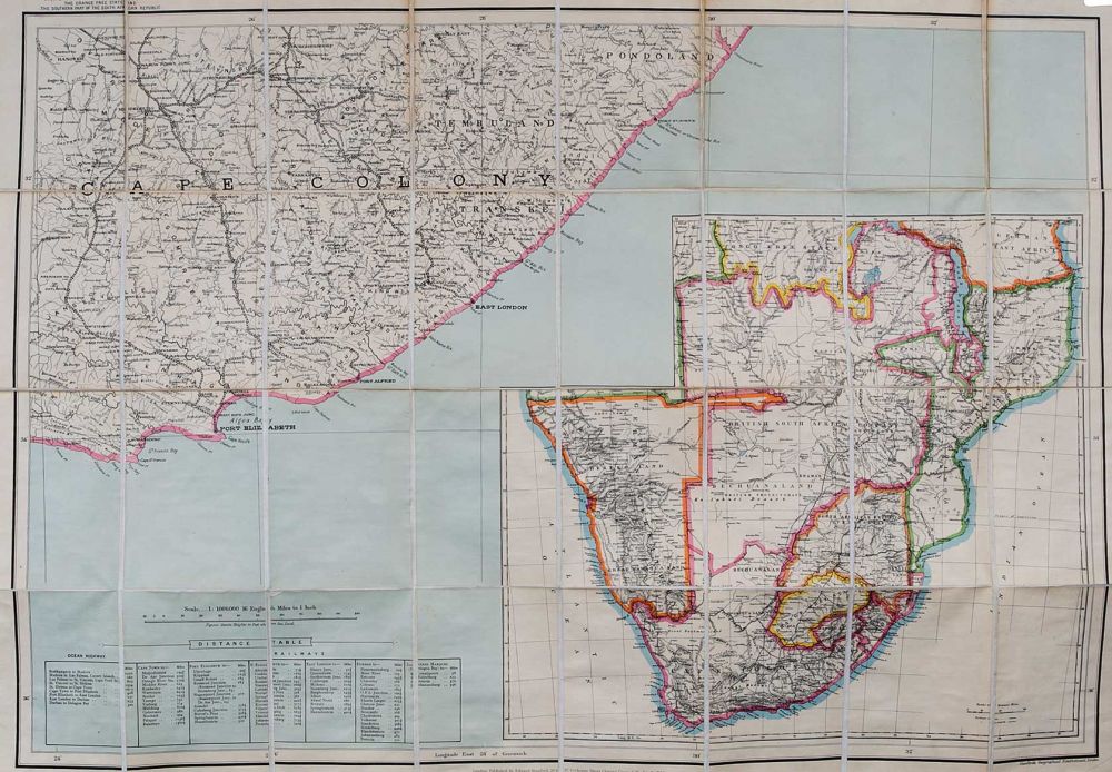
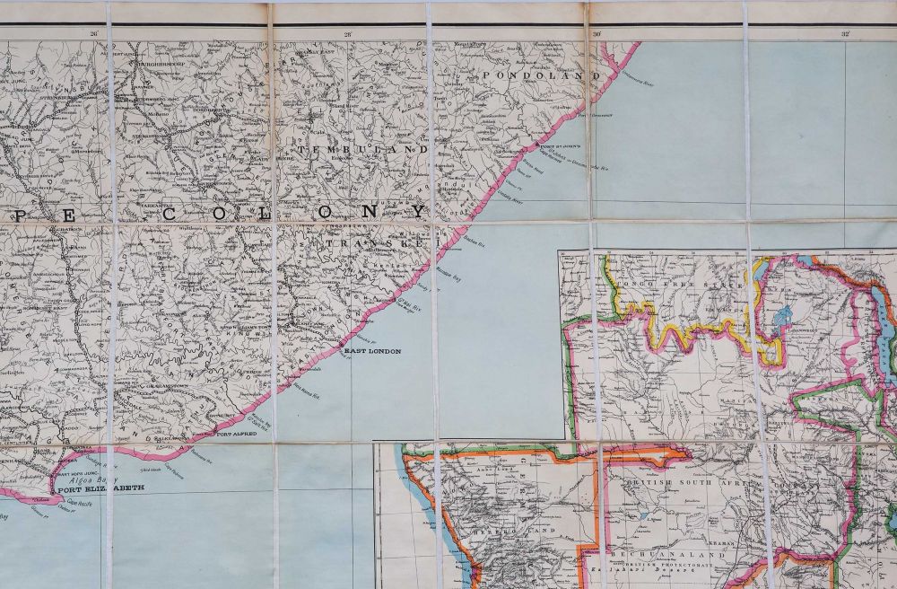
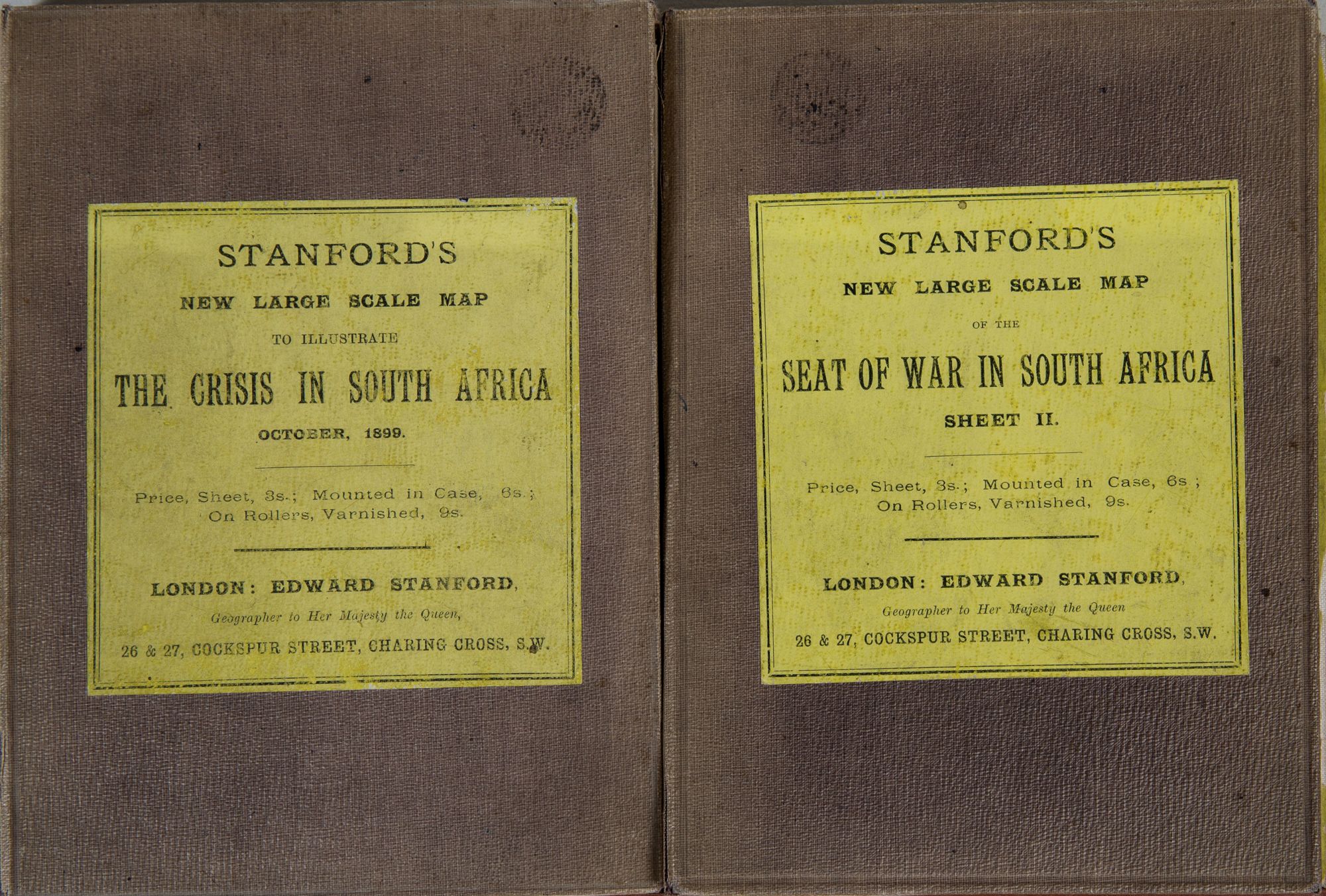
London: Stanford, 1900. 1899/1900. No Binding. Stanford's New Map of the Orange Free State, the southern part of the South African Republic, the northern frontiers of the Cape Colony, Natal, Basutoland, and Delagoa Bay in Portuguese East Africa. 1899. Cover title: Stanford's new large scale map to illustrate the crisis in South Africa Oct 1899 WITH Southern Extension of Stanford's New Map of the Orange Free State and the Southern Tip of the South African Republic. Cover title: Stanford's new large scale map of the seat of war in South Africa. sheet 2. Folding linen backed maps in orig board covers & labels. Each sheet 27 x 39 in. 16 mi to the in. Both maps vg+ w. slightly faded cover. Sheet two shows both the Eastern Cape and all British controlled southern Africa on a scale of 94 mi to the in. Sheet on Oct 10, 1899 and sheet 2 Jan 9, 1900. Both Stanford London. VG+. Item #2436
Price: $500.00